Bringing the flooding of the valley under control has shaped the positioning of the City of Pacific.
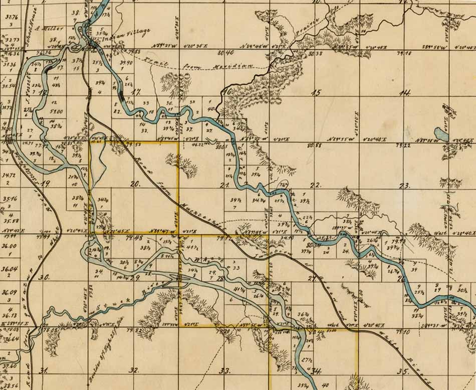
| This map from U.S.
General Land Office, was surveyed in part by
Ezra Meeker on August
13,
1867.
There is one road coming from the southeast to
the Muckleshoot Indian Village. On the west edge
of the map is a road from the Puyallup River to
the Green River. T21N R5E |
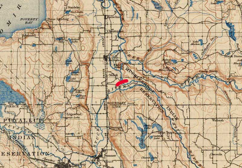
| This map by U.S. General Land Office in 1894, shows the White and Stuck Rivers entering the Green River, at a point north of Auburn. The red line shows where a dam 1,600 feet long and 14 feet high was added. Further, 4,000 feet of ditching and levees were added in 1914 near Auburn Game Farm Park. As a result the White River no longer flowed north into the Green River, but flowed south into the Stuck River towards Tacoma. Therefore the Green River, as it is known today, is separated from the White River and flows north to Seattle. (Formerly the Stuck River was just a small stream.) By the way "Stuck" comes from the Lushootseed word stéq for log jam or stəx̣ for plowed through.(1) |
Land use changed. At first farmers sought to grow crops. However, as the floods were brought under control, houses and warehouses replaced farmland. Population growth was considerable as flood control improved.(7) Those people who are living near the White River now have access to a mobile phone app that tells the flood alert level of the River.(8)